+7 (812) 328 9282 - Office, +7 (812) 328 9248 - Museum info@karpinskyinstitute.ru
Russian Geological Research Institute (VSEGEI)
From August 8 till September 17, 2020, the Tikshozersky Field Party of the Regional Geology and Mineral Resources of the Western Regions Department carried out field works as a part of the first stage of the GDP-200 sheet Q-36-XIV (Tikshozersky area) in North Karelia and the Murmansk region.
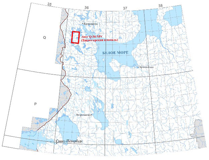
Layout of sheet Q-36-XIV (Tikshozersky area)
The work was carried out at 4 reference sites, where both mapping, and prospecting and assessment tasks were solved. To solve mapping problems, routes at 1:200,000 scale were carried out, aimed at additional study of the rocks of the Tikshozersky Group, clarification of their age, composition, tectonic position and development areas. The genesis, age, thickness and lithological composition of the Quaternary deposits were also specified.
To solve prospecting and assesment tasks, prospecting routes at 1: 50,000 scale and detailed routes at 1:10,000 scale were carried out in the northeastern part of the leaf, in order to clarify the areas of development of metasomatites of various formational groups, their composition and identify factors that contribute to the localization of possible gold mineralization.
As part of the work, furrow sampling of the proposed ore zones identified in the northeastern part of the sheet was carried out at the prospecting and survey Lisegorsky area. The thickness of the identified zones reached 1.7 m. Samples were taken from zones with visible hydrothermal alteration, migmatization, silicification, and sulfidization. Also, for prospecting purposes, in the process of field work, detailed geochemical works were carried out at 1:10,000 scale, to verify the anomalies of gold content in loose sediments identified by the work of predecessors.
The northeastern part of sheet Q-36-XIV is the most promising for the identification of gold ore mineralization, associated primarily with vein hydrothermalites of quartz, quartz with sulfides composition, filling the central parts of ore-bearing zones of hydrothermal-metasomatic alteration of the Tikshozersky greenstone structure.
The amphibolites and shales of the Tikshozersky Group are most closely related to gold mineralization.
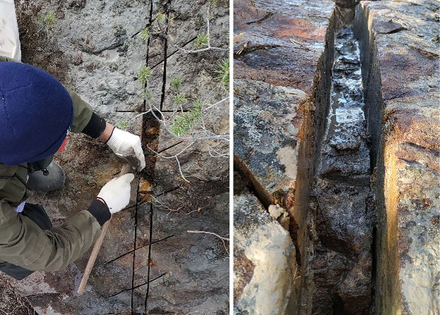
Furrow sampling in potentially ore bearing zones
Field work was carried out using the “Sherpa” software complex developed by the VSEGEI for operational documentation of primary field data on laptops. In the cameral period, the materials obtained are exported to the database and used to build maps of the modern geological base.
As a result of the work performed, all the tasks were solved in full. The pre-Quaternary formations of the Tikshozersky Group were sampled, represented by the rocks of the Khizovar, Chelozerskaya, and Verkhneozerskaya formations. The Quaternary deposits, presented on the territory of sheet Q-36-XIV, which have not been mapped before, have been studied and tested. The total length of route surveys of various scales was more than 300 linear kilometers. For further laboratory and analytical studies at the Central Laboratory and the Center for Isotope Research of the VSEGEI, the specialists of the Tikshozersky Group took more than 2500 samples and samples.
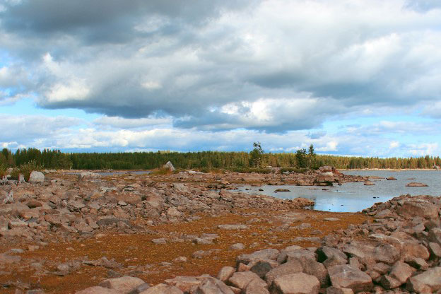
Boulder collapses on the coast of Lake Srednie Kitchany
The information obtained in the course of field work will make it possible to clarify the genesis, composition, age, boundaries and areas of development common in the studied territory of geological formations. The processing of materials obtained in the course of exploration work will make it possible to identify patterns in the location of mineral deposits, factors and criteria for predicting them, as well as identify mineragenic taxa that are promising for the discovery of mineral deposits.

